Live web app
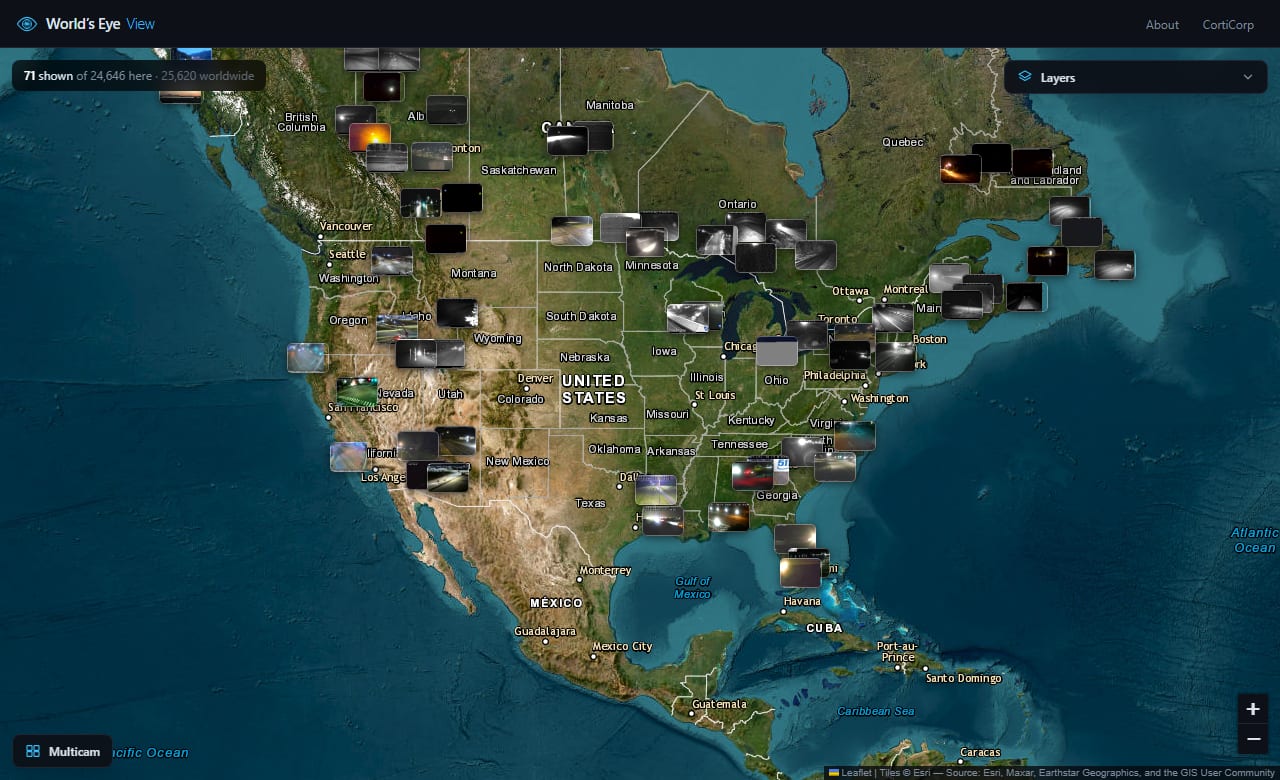
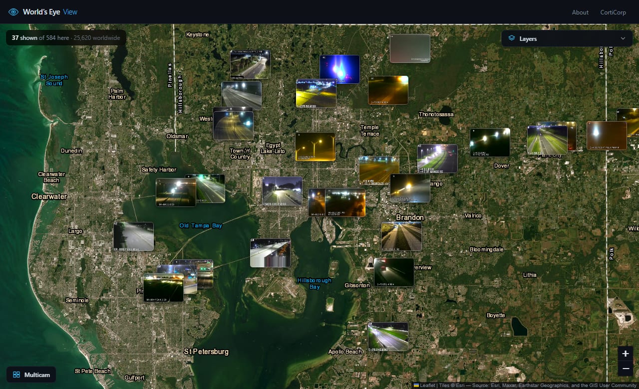
Around 34,700 public webcams from 31 sources, stitched onto a single satellite map as live thumbnails. Zoom out and you see the notable ones: volcanoes, harbours, landmark city streets. Zoom in and a city fills with windows. Click any camera to watch it full screen, or send several to a multicam wall and watch them together. Because every frame is real and refreshes on its own schedule, the map drifts through the day with the world: you can watch dawn cross a continent, or find a city already dark hours before its neighbour.
Newer: sign in to keep your walls in folders and publish one to a public gallery, find the cameras along a driving route, or ask for the cameras where the sun is about to rise or set.
What it does
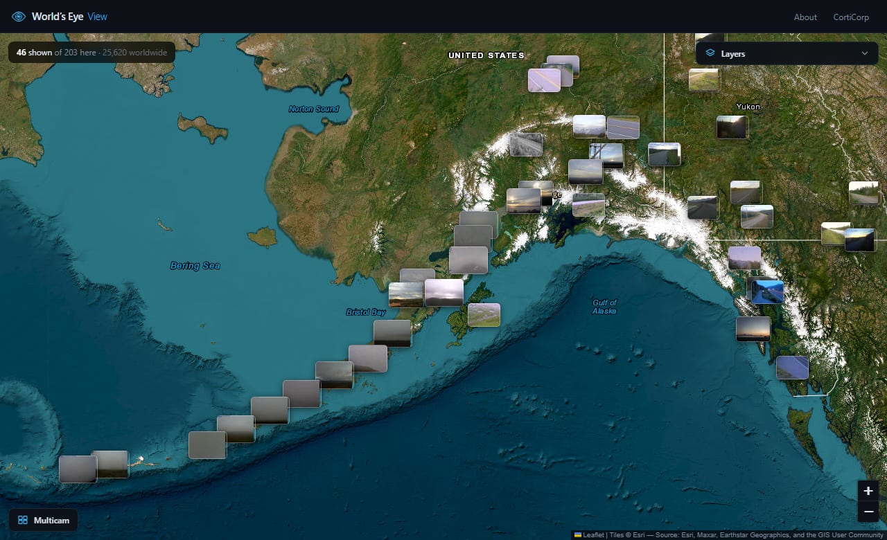
Every camera draws as its own live frame, sized in proportion to how notable it is and how far you’ve zoomed in. The map stays a map — cameras never carpet it.
Frames refresh on each camera’s own cadence, so the wall of thumbnails darkens and brightens with real daylight rather than sitting frozen.
Send any camera to a grid that arranges itself into a rectangle and resizes as you add or remove feeds. Your wall is remembered between visits.
Filter by what you’re looking at (volcanoes, harbours, roads) or by who runs it — so “only the Florida DOT cameras” is a single click.
Give it two places and it returns the cameras strung along the drive between them, in order, which is a different question from “what is near me” and a more useful one before setting off.
Search a place by name, use your own location, or ask for the cameras where sunrise or sunset is happening right now anywhere on earth.
Sign in to keep your walls in folders across devices, publish one to a public gallery, or browse what other people have published. The map itself needs no account and works unchanged without the database behind it.
The controls fit across the top on a narrow screen, a big wall scrolls instead of squeezing itself into unreadable tiles, and a tap expands a single camera to full screen.
Sources
Every camera is published openly by the agency that operates it. Nothing is scraped from a closed system. Counts below are the live totals the map itself reports.
| Source | Cameras | Coverage |
|---|---|---|
| Windy Webcams | ~7,140 | Worldwide, and the source that fills in everything outside North America and northern Europe: observatories, zoos, beaches, landmarks |
| 511 traveler information | ~20,350 | 14 US states and 8 Canadian provinces and territories. Florida at 4,872 and Georgia at 4,043 are the two largest single feeds |
| Caltrans CCTV | ~3,320 | California highways |
| DriveBC | ~1,020 | British Columbia, which runs its own software rather than the shared 511 platform |
| Hong Kong Transport Department | ~1,010 | Hong Kong roads and tunnels |
| Fintraffic | ~810 | Finland — far enough north that part of it sits in polar night in midwinter |
| Transport for London | ~790 | JamCams across Greater London |
| NZ Transport Agency | ~250 | New Zealand, the only southern-hemisphere road source, which is what makes the day/night line read correctly on a world view |
| USGS Alaska Volcano Observatory | 66 | Active volcanoes and the communities downwind of them |
| LTA Singapore | 8 | Expressway cameras: small, but a second Asian source |
By subject rather than by operator, that is roughly 29,400 road cameras, 3,000 city views, 1,220 weather cameras, 600 harbours, 400 mountains, 83 airports, 45 volcanoes and a dozen observatories. Every source except Windy is free and needs no key at all, so the map still works without one; Windy is what makes it a world map rather than a North Atlantic one.
Closer look
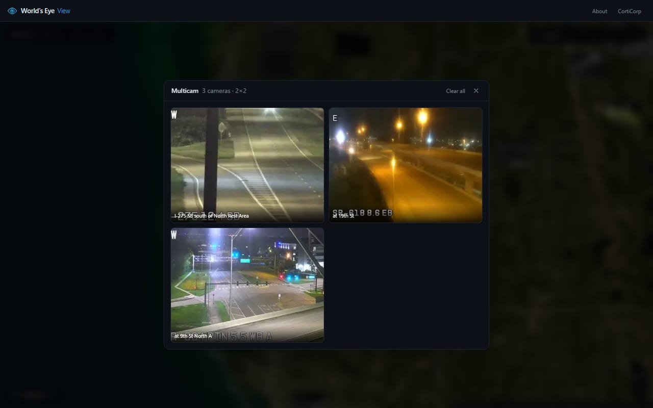
Columns are the square root of the camera count, so the wall always aims at a rectangle rather than a long row. Past a certain size the tiles shrink instead of the panel growing off screen.
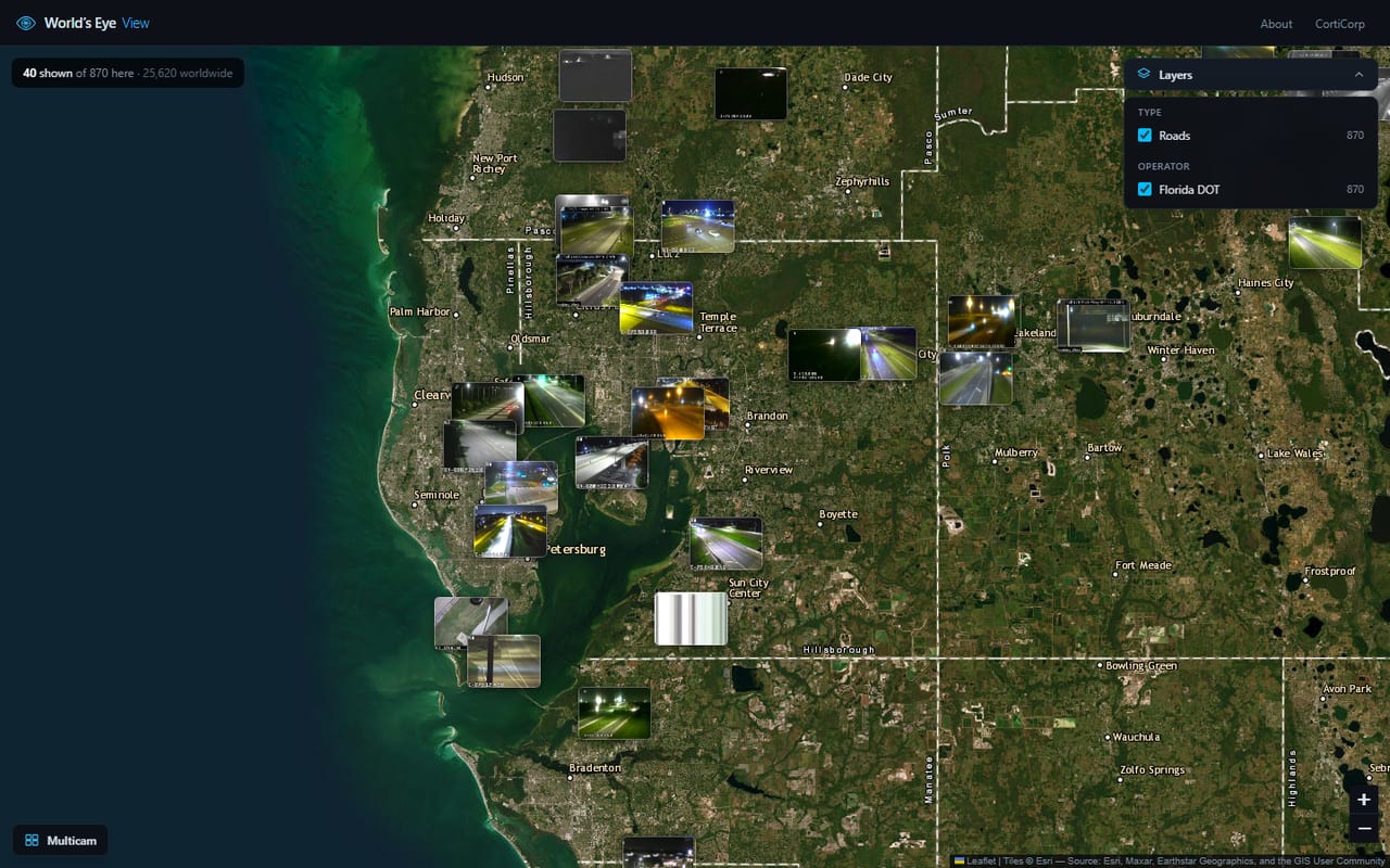
Counts are for everything in view, not just what fit on screen — so isolating a layer genuinely reveals cameras that lost their slot while everything else was switched on.
Under the hood
Thirty-four thousand cameras will not fit on a screen, so the server decides who gets a slot: it projects every candidate into screen pixels at your current zoom, drops them into thumbnail-sized grid cells, and keeps the most interesting camera in each. Zooming in shrinks the ground each cell covers, so the highway cameras that lost to a volcano at country scale reappear on their own once there’s room.
Frames are fetched and downscaled server-side — roughly 6KB each instead of 120KB, which is the difference between a map that loads and one that doesn’t. That also means every image arrives from a single origin, so the site’s content-security policy never has to trust the dozens of third-party hosts the cameras actually live on. Cameras that stop responding, or that answer with a “temporarily unavailable” placeholder card, are detected and dropped rather than left as dead tiles.
The map itself has no database and no scheduled job. The whole catalogue is rebuilt in memory on boot and refreshed per source in the background. A database exists only for the optional accounts and saved walls, and the separation is deliberate: if it went away entirely, the map would carry on working.